Amery Falls
Oh the month of May! I used to love this month when I lived on the east side of the country. It’s a different story now. I always look at the weather forecast for this month with suspicion now that I live near the mountains. It’s always a mixed bag of snow, hail or hot and sunny weather. Nobody around me is foolish enough to call May spring. In the mountains around here, winter is from September to June!
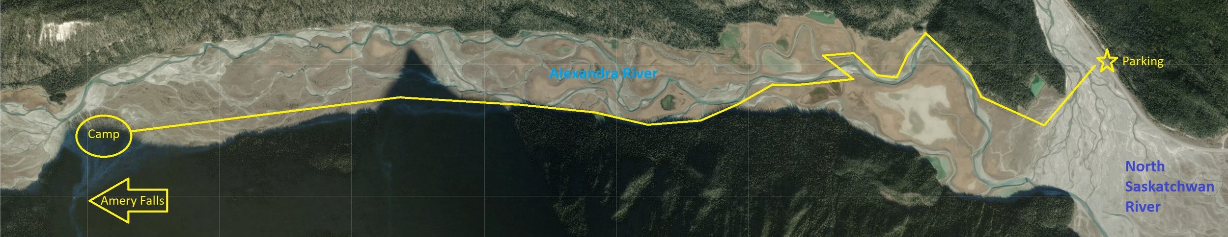
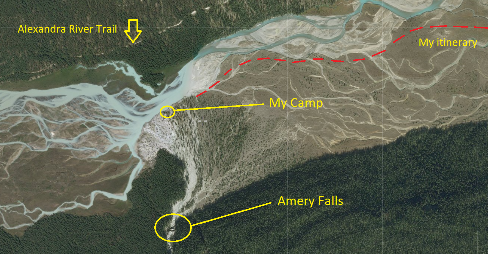
I had a pretty calm winter in terms of wilderness activities. Not because I don’t like winter, but because the ongoing renovations at my house kept me quite busy. Now luckily for me, a weekend of extremely nice weather was in the forecast at the beginning of the month. My options were limited to valleys at lower elevation but I was excited to see that the Alexandra River valley was snow-free on the satellite imagery.
There was a place along the river I had spotted in the past while packrafting down the river. It was the mouth of Amery Creek. I had read somewhere online that there was a waterfall near the mouth and also a nice big flat floodplain that would make a great random camping area. For the first trip of the season, this plan was perfect. I knew the area pretty well and the low water level gave me the perfect opportunity to discover this area that is inaccessible the rest of the year due to higher water in both the Alexandra and North Saskatchewan Rivers and the fact that the falls are on the opposite side of the river from where the trail is.
The first thing I noticed along the road was how fresh the air was. Nearly 20°C for early May, unbelievable! The road was dry the entire 285 kilometers. But winter was still surrounding me with snowbanks up to 5 feet tall on each side.


Bow Lake, still completely frozen.

The reason why I wanted to stay at lower elevation: avalanches, as seen on Mount Jimmy Simpson above Bow Lake.
I stopped at the Silverhorn campground on the way in to take a break from the long drive. I also made sure to take my first sip of glacial water of the year from the creek. De-li-ci-ous!

Over time, I’ve got to know pretty much what’s behind every curve along the Icefields Parkway, but at the beginning of the 20th century and long before the construction of the road, early explorers and outfitters travelling the Canadian Rockies used natural landmarks as a form of bearing. One of the most mentioned landmarks in the books I have read is the “Lighthouse”, the 246ft tall pinnacle located on the eastern ridge of Mount Saskatchewan. To this day, every time I drive north on the Icefields Parkway, I know that my beloved Alexandra River is just ahead when I see the Lighthouse from the road.

The impressive Mount Saskatchewan (10,965ft) and its “Lighthouse”.
I parked my truck after having confirmed that the North Saskatchewan was easily crossable. I had brought my packrafting shoes and they were effective to cross the snowy flats and the multiple channels on my way to the Alexandra valley.


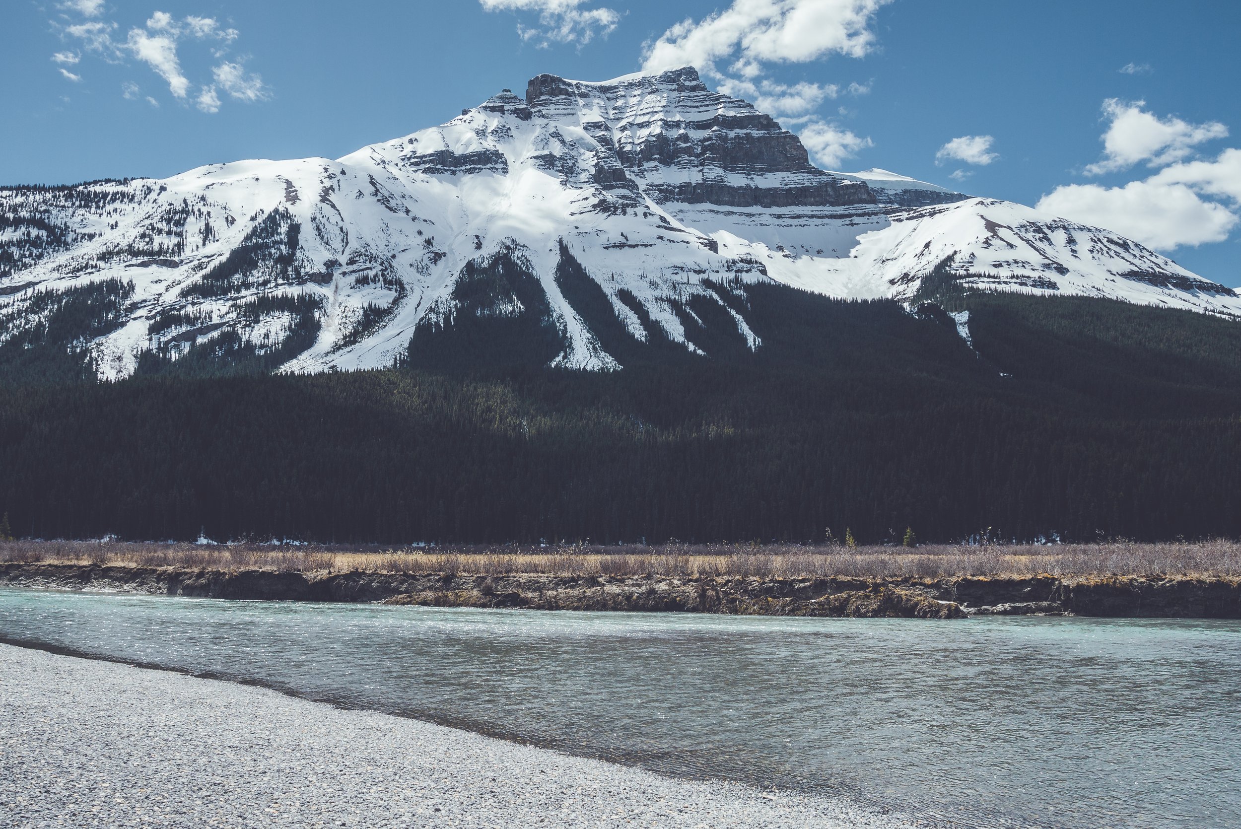
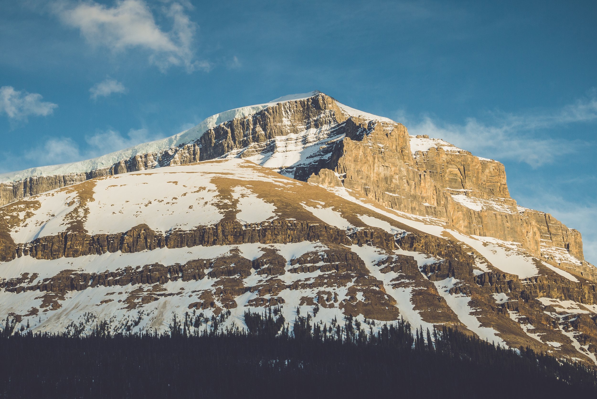
Mount Amery (10,922ft) at the confluence of the Alexandra and North Saskatchewan Rivers.

A few snow bridges on top of active channels, all still strong enough to safely support my weight.
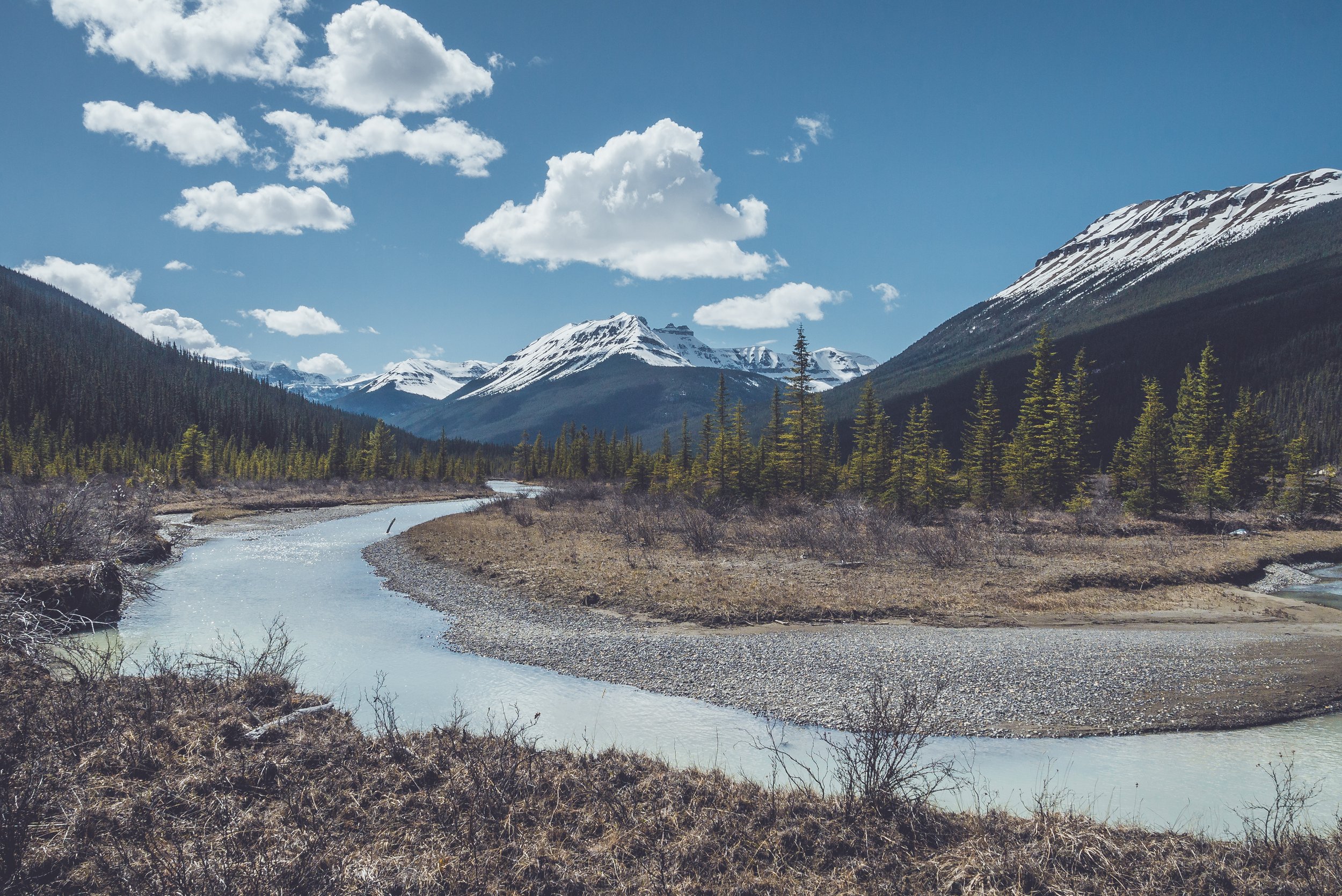
Approaching the Alexandra River, I couldn’t stop smiling. After a long winter hiatus, I was back in a place that will always be close to my heart. I have nothing but good memories in this area. Almost a year ago, I was walking here along the river with my friend Michal on our way to Alexandra Lake. One could think I will eventually get bored of this place, but it’s actually the opposite. The Alexandra River has so many tributaries emerging from hidden valleys that the opportunities for exploration are almost endless. And this weekend was just that, a chance to experience a very specific area that I had circled on my map a few months ago.

Alexandra River and Mount Saskatchewan
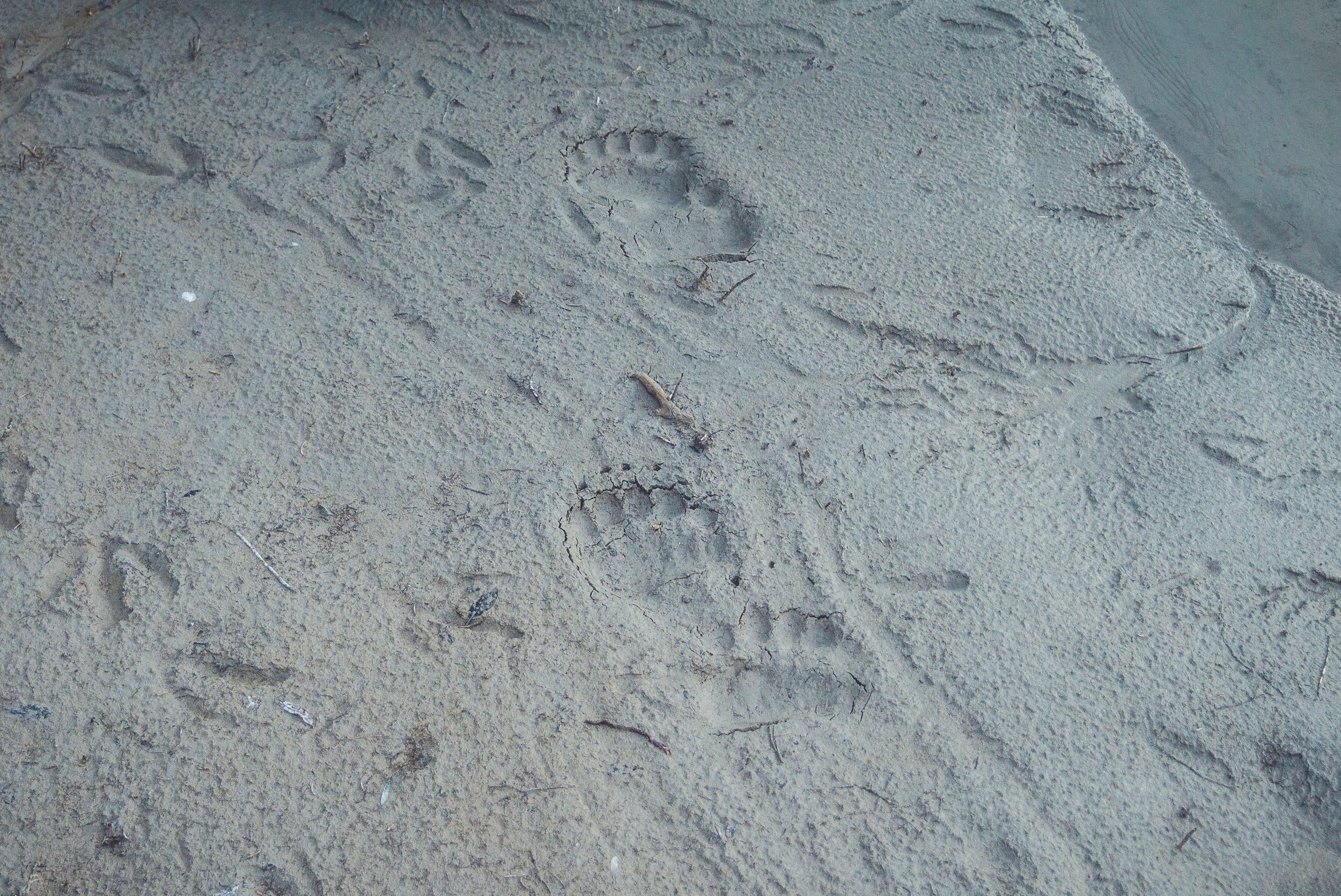
You’re never alone in the mountains. These grizzly tracks were going the opposite direction but looked fairly recent.

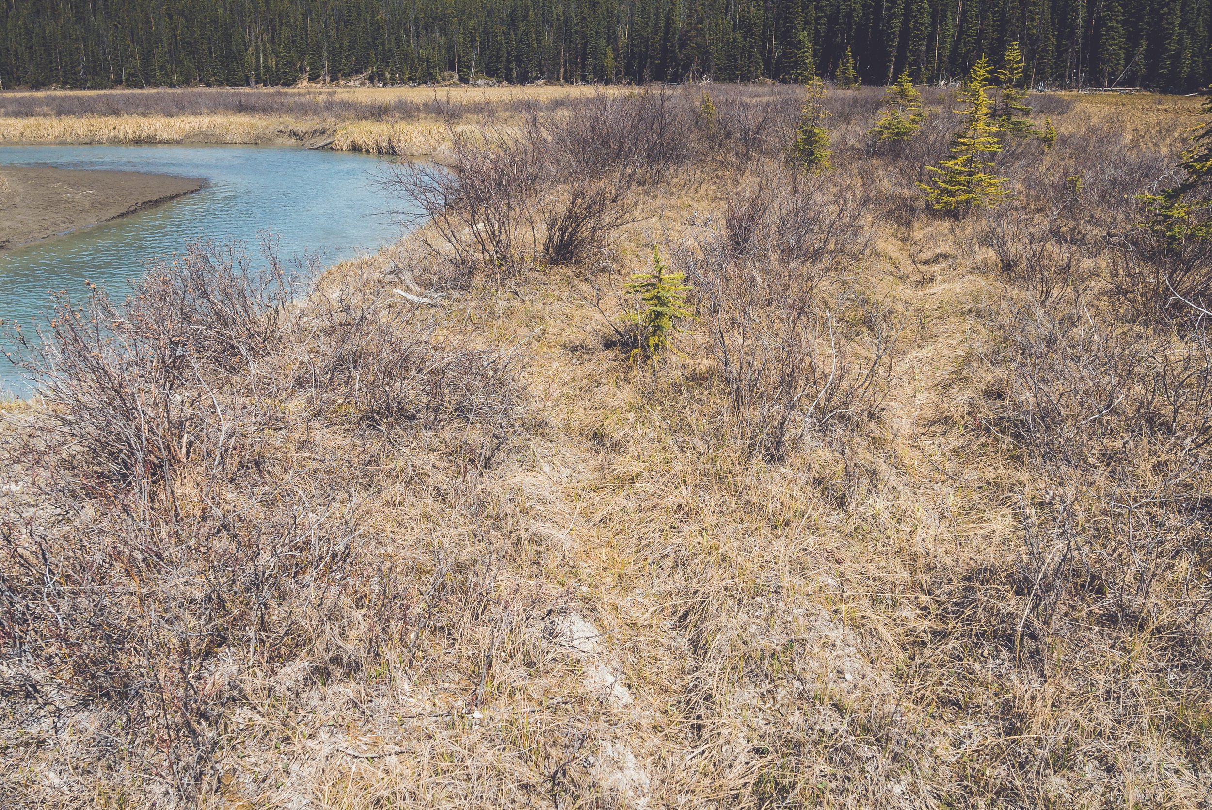
One of the reasons I like this valley so much is because of its seclusion. The river can’t be seen from the highway because of a big curve before reaching the North Saskatchewan. But if you enter the valley on foot via the river flats and look back, both tips of land on each side of the river almost look like arms closing on each others after letting you in.

And once I was in, there was nothing else to enjoy than this vast wilderness. Apart from the occasional flock of geese lounging in the sun, the sound of my footsteps on the dry grass was the only thing that would compete with the silence of my surroundings.


Last time with Michal, we used the river flats to skip a long section of trail but quickly regained the main trail in the trees. So from now on, I was facing the unknown in regards to my itinerary. I knew that at some point I would have to cross the Alexandra in order to reach Amery Creek. Yes, the river was low but there was always a deeper section on either side of it. I had marked a potential crossing location on my GPS, based solely on the width of the river. When I reached that location, I left my backpack on the shore and proceeded to test the water. It turned out to be a good spot to cross. My feet got numb from the extended time spent walking across.


Mission accomplished, I was safe and sound and only wet up to my knees.


Mount Coleman (10,285ft), on the other side of the highway.
All was left to do was to follow the river for another 5KM until I come across Amery Creek.

The views of Mount Amery were great. It stood tall above me and the snow on it was sparkling under the bright sun.


A bald eagle circling high in the sky above me.

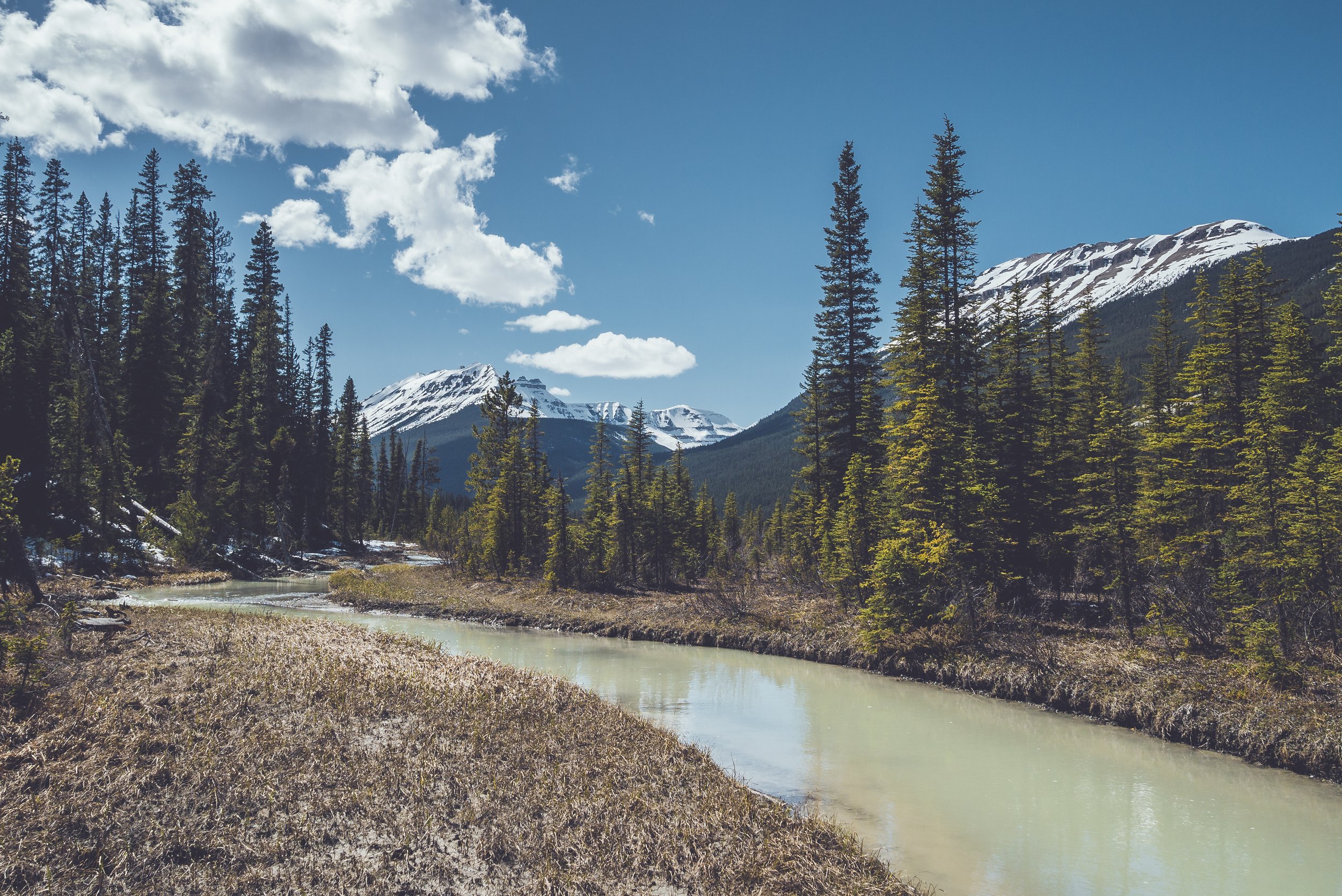
On occasion, I had to skirt around deep channels and walk along the the forest. There was always an animal trail along the river. But when I could, I stuck to the flats even if it meant walking in mud of soft grass.


My friend Grizz, again.


The Castelets, in the background (center).
After walking through a very muddy area for a while, I was back along the main channel of the Alexandra. Suddenly, I noticed something moving in a water hole next to me. To my big surprise, a small trout was trying to hide from me. Even if I knew that Watchman Lake (on the Continental Divide, near the Castleguard Meadows) had been stocked with trout in the past, it’s still a long way down from it to the Castleguard River and finally the Alexandra. I doubt it will survive because it was swimming in a big water hole that was isolated from the main channel. Interesting sighting though!

It was early in the afternoon when my destination was reached. While I was really happy to have a clear view of Mount Alexandra and its glaciers, the vicinity of Amery Creek was different than what I had in mind from the satellite imagery. I thought there would be way more grass but it turns out that this entire area is a more a rocky floodplain from Amery Creek. It must be completely flooded during the spring meltdown, hence the rocks, sand and debris found all over the place.


In the shadow of Mount Amery and its glacier on top.
It made it hard to find a flat spot to pitch my tent. But lucky for me, it has a small footprint and the perfect location was found just a few feet from the river.

Random camping will always be my preferred way of spending a night in the Rockies. No tent pads, picnic tables or bear lockers to remind me that a thousand of campers have been here before me. I love the freedom of choosing my own place to sleep, find my eating area and the most important thing: choosing my views!


Home for the night!
With my camp set up, it was time to go check out the falls. With the floodplain almost completely dry, I wasn’t sure what to expect. It was still early in the season and with Mount Amery still covered in snow, there was a chance that the falls might be running dry. But after making my way there and despite the snow, I was greeted by a nice running waterfall.

Amery Falls

The lower section.
I was able to climb up and above the first falls to gain access to the upper ones. I knew from my research that there was a narrow canyon higher up and while I could see the beginning of it, it was pointless to try to climb higher with the snow covering the rocks on both sides.

The upper section.
I stayed here for a while, thinking about a future trip up to the headwaters of Amery Creek. I followed the dry creek bed all the way back to my camp.

Looking back at the Alexandra River valley below from the upper falls.

What is usually the main channel of Amery Creek at the junction with the Alexandra River.
With plenty of daylight left, I brought my cook kit, food bag and my book to the river’s edge for a relaxing evening spent reading, cooking and eating.


My spot for the evening with the sun shining through the Terrace Creek Valley between Mount Saskatchewan and The Castelets.

Summit block of Mount Willerval (10,465ft), just west of Mount Amery.
Is there a better way to start a new hiking season than enjoying the golden hour below a glacier?


After dinner, I safely stored my food and enjoyed my usual “post-dinner” walk around my camp to inspect the area for bears or critters that might be around and cause me trouble overnight. I walked past my camp for an hour. The sandy area made it easy for me to find tracks near the river. I saw what appeared to be the same grizzly tracks I had seen earlier and they were going deeper into the valley. That’s all I could find so I wasn’t too worried for the upcoming night.


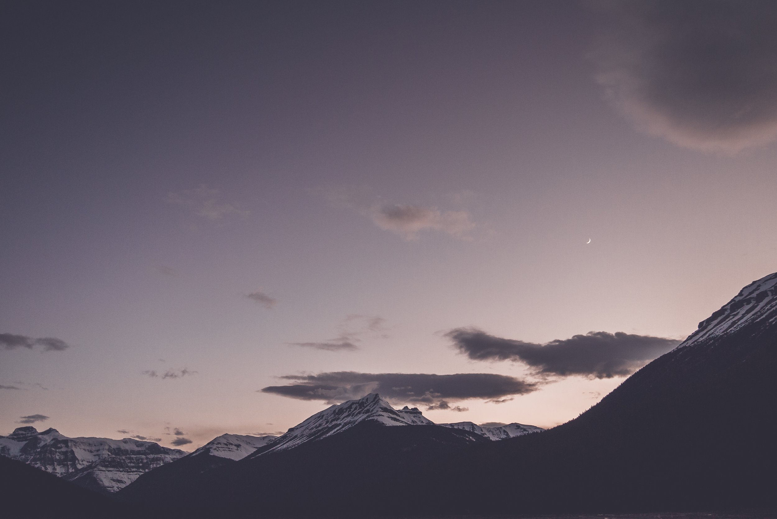
I came back to camp just as the darkness set in and when the moon and the stars were finally visible in the purple sky.
I slept like a baby and woke up just in time for a magnificent sunrise. The temperature dipped slightly below freezing but I stayed comfortable all night long. Camping right next to river was putting me at risk of colder temperature and condensation in my tent, but some light frost on my backpack was the only small price to pay to falling asleep to the sound of the river.


As soon as the sun rose from behind the mountains to the east, the temperature climbed drastically. It was supposed to be the warmest day of the weekend and in no time after packing up camp, I was sweating and taking off my t-shirt. Temperature in the mid-twenties in early May? Yes please!

Leaving Amery Creek behind, I chose a different itinerary for my way back, staying closer to the river all the way this time.


A last look at the Alexandra Glaciers before heading out.
I had to deal with more river crossings but I always enjoy them anyway.

A tripod for my camera, supplied by Mother Nature.

Arriving at the same spot I had used the day before to cross the river, I noticed that the level and flow were higher and stronger. The warm temperature from the previous day had accelerated the meltdown and I now faced a precarious crossing, to a point where I packed everything in my backpack, camera included, to really focus on the ford.
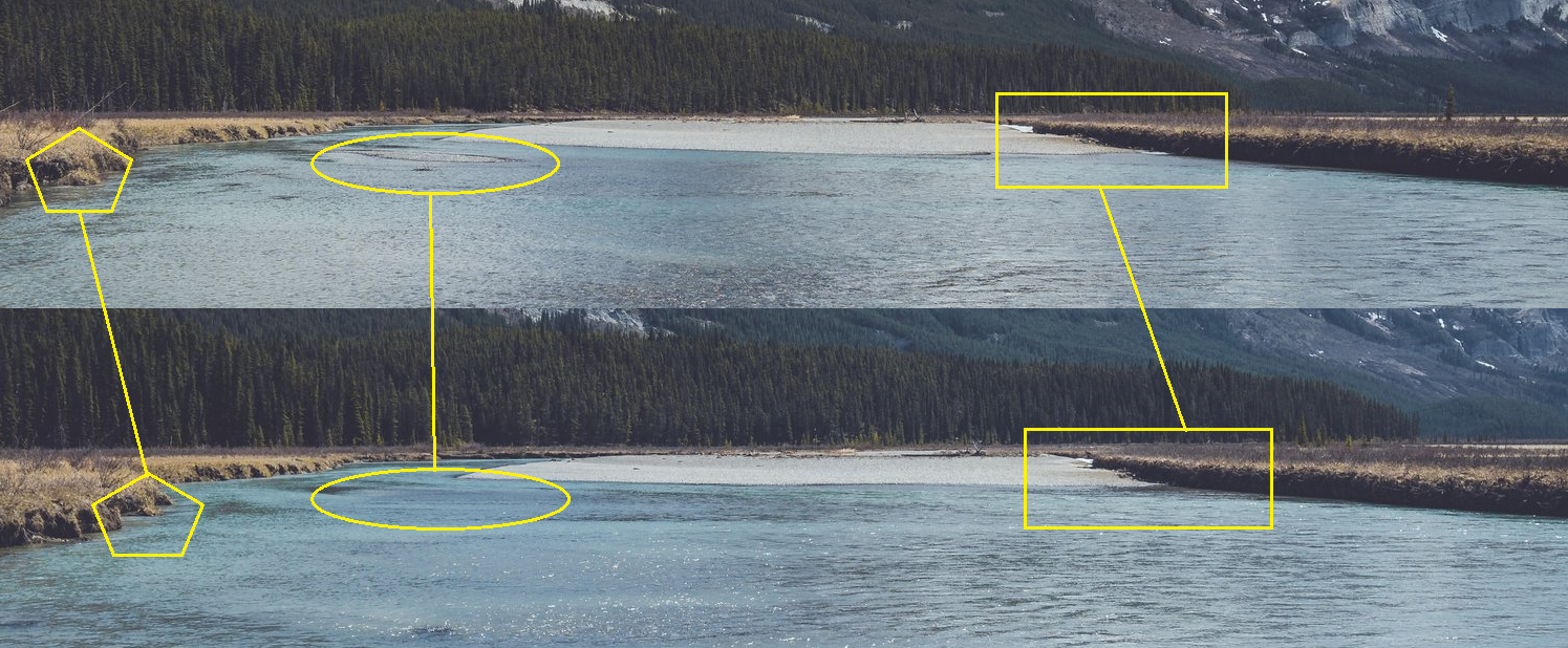
The water level difference from Saturday (above) to Sunday (below). While it might be less obvious from the pictures, the river was a full foot higher than 24 hours before.
With the tiny rock island submerged, I had to cross in a single traverse with no chance to rest half-way. I made it, but the water had reached an inch below my waist. It is to this day the most painful crossing I had to endure cold-wise. I was so numb from my waist down that I could barely walk for a few minutes.

Fortunately, the hot temperature quickly warmed my legs back up. It’s crazy to witness such a rapid body temperature drop with less than a minute spent crossing a river.

I was almost back at the North Saskatchewan River and finding an animal trail made things easier as the tall grass had already been stumped down for me. But I was in no hurry and enjoyed every single minute of a second beautiful day in a row.


Walking away from the Alexandra and before crossing the North Saskatchewan River to end my hike, I wanted to make a small detour to the area near the confluence of both rivers and explore it for a bit. This place is known as the “Graveyard Flats” and is also mentioned quite a lot in the books from the early 1900’s. The name comes from the fact that this used to be an important junction where Indigenous people and outfitters would meet and process the animals trapped and hunted and leave behind their remains and bones. The only thing I was able to find was evidence of an old trappers camp. I packed up the rusted cans to prevent more soil contamination.


With the highway in sight, my 2-day trip was ending. I was excited for the summer to come. There was no sign of closures in the National Parks due to Covid like in 2020. The only thing left to do was to wait for the snow to melt to be able to access higher elevations…


… but the drive back home reminded me that summer in the Rockies was still a solid two-months away!

Seeing Mount Rundle near the town of Banff being almost snow-free gave me hope of an early spring meltdown. But these hopeful thoughts were crushed when a snowstorm left almost a foot of snow on the Alexandra River Valley two days after this trip. At least I was able to take advantage of a stunning weekend. This might just be the beginning of a new early-season tradition, who knows?
