Bourgeau Lake
For a day hike, the weather forecast doesn't really matter to me. I always pack up my rain gear and a few layers when heading to the mountains and take advantage of any bad weather to test my gear and my different clothing options. This time was no different. I only had less than 8 hours to spend outside on this Saturday of July so I chose to hike up to Bourgeau Lake because of how relatively close it is to Banff and therefore to Calgary. I arrived early at the trailhead to beat the crowds. The weather was moody and I started hiking with a gut feeling that it would turn for the worst.
Bourgeau Lake sits halfway up Mount Bourgeau, both names after Eugene Bourgeau, a French naturalist who was part of the Palliser Expedition between 1857 and 1860. There is a very interesting book about this expedition written by author Irene Spry named The Palliser Expedition that I highly recommend to whoever is curious about the Canadian Rockies.

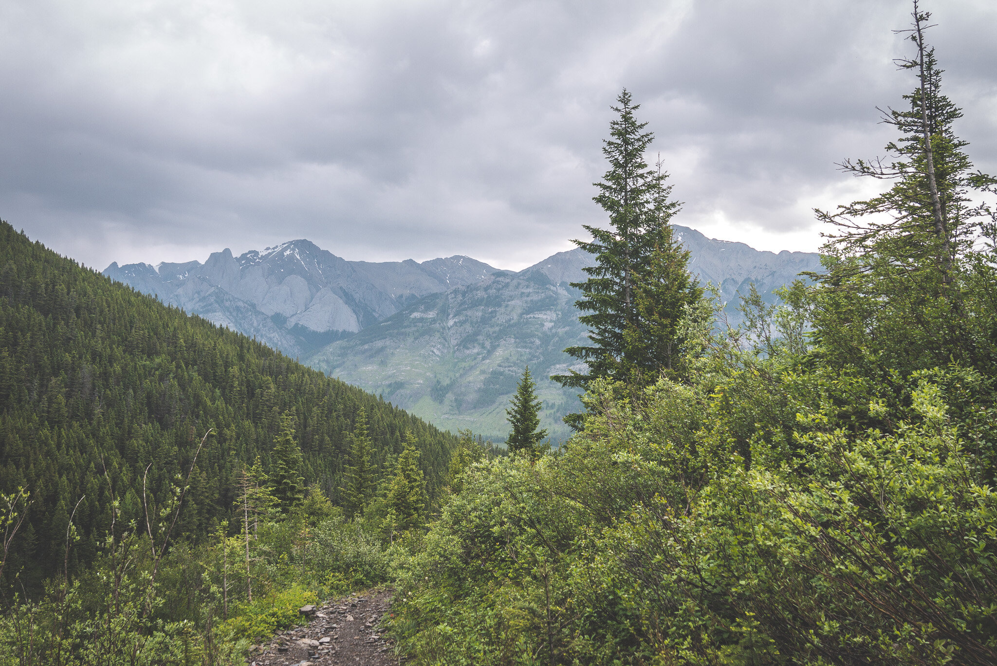
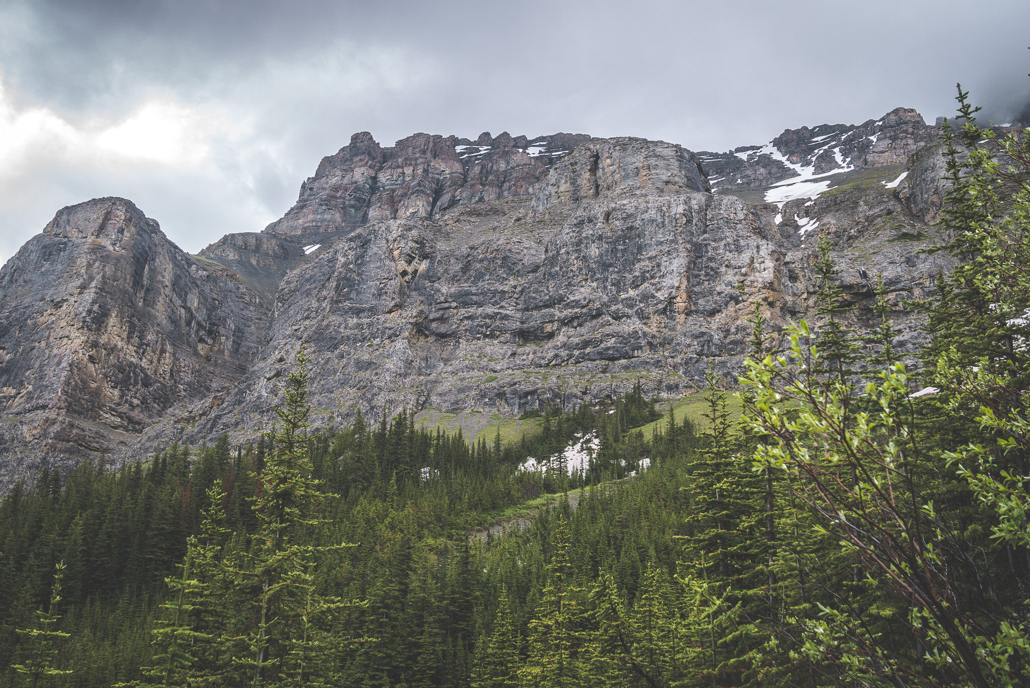
After half-an-hour, the views were opening up. It was chilly, with the temperature at around 9°C.

Looking back East with The Finger on the left and Mount Cory on the right.


The clouds were low. Clearly, there was a lot of moisture in the air up there and I was expecting some rain or even snow to fall at any moment.

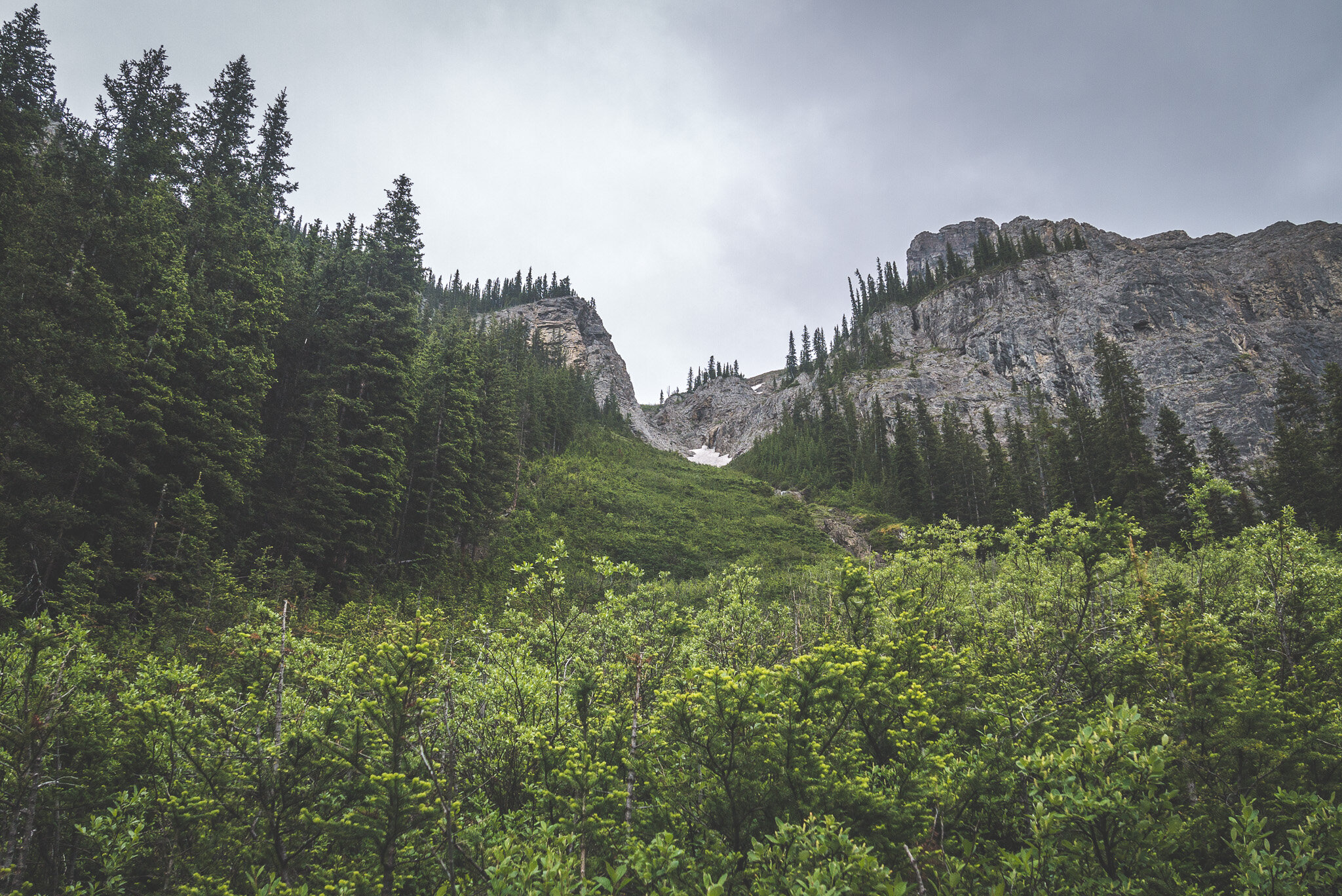
This snow "cave" was neat. I took a look at it from a distance, but didn't miss the opportunity to taste the water from its waterfall.

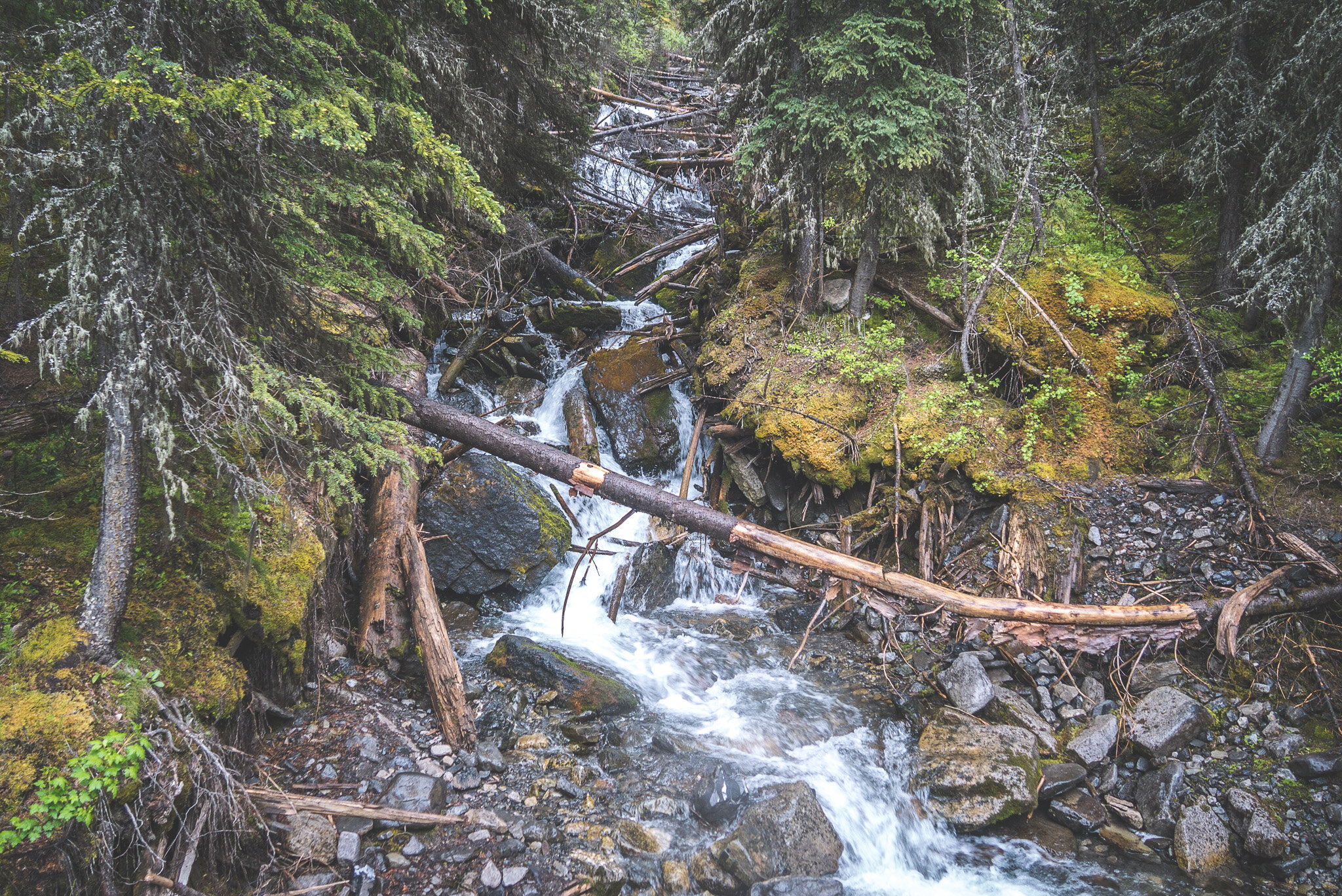
Things got interesting when I reached this major creek. It was very fast, the water was freezing and it was filled with fallen trees from an avalanche. The only way across while staying dry was the snow bridge.


While I usually don't mind getting wet crossing creeks and rivers, it wasn't the case this time. The temperature was now only a few degrees above freezing. Not the right conditions to hike with wet feet. But a snow bridge is dangerous. Falling in the middle could pin you down under the ice with water flowing around you. I poked it with my hiking pole to find out the snow was well frozen. The tree looked like it had been used by a previous hiker but it was so soft that it wasn't an option. I felt like I could jump across and avoid the middle section. So I did just that and it went well. A situation like this is all about risk assessment and risk management, two important steps to understand and use while facing risky situations.

Snow, ice and avalanche debris completely engulfed the creek a few feet downstream.


Then, it happened. In the blink of an eye, rain starting pouring. It came down so hard that I had to take cover under a large spruce tree. I had my rain pants and jacket on but my hands were cold as my fleece gloves got wet before I had enough time to put my shell mittens on top of them. The eye of the storm had passed by and I resumed my hike up to the lake. I crossed a few people running down from the lake, but I wasn't ready to turn around despite the precipitations. I enjoyed it because moments like this allow me to test my gear in extreme conditions without any real consequences in case of a gear failure. I learn a lot from bad weather days like this one. I'd rather know if something doesn't work while being only a few kilometers from my car then when I am on a longer trip and more than a day away.

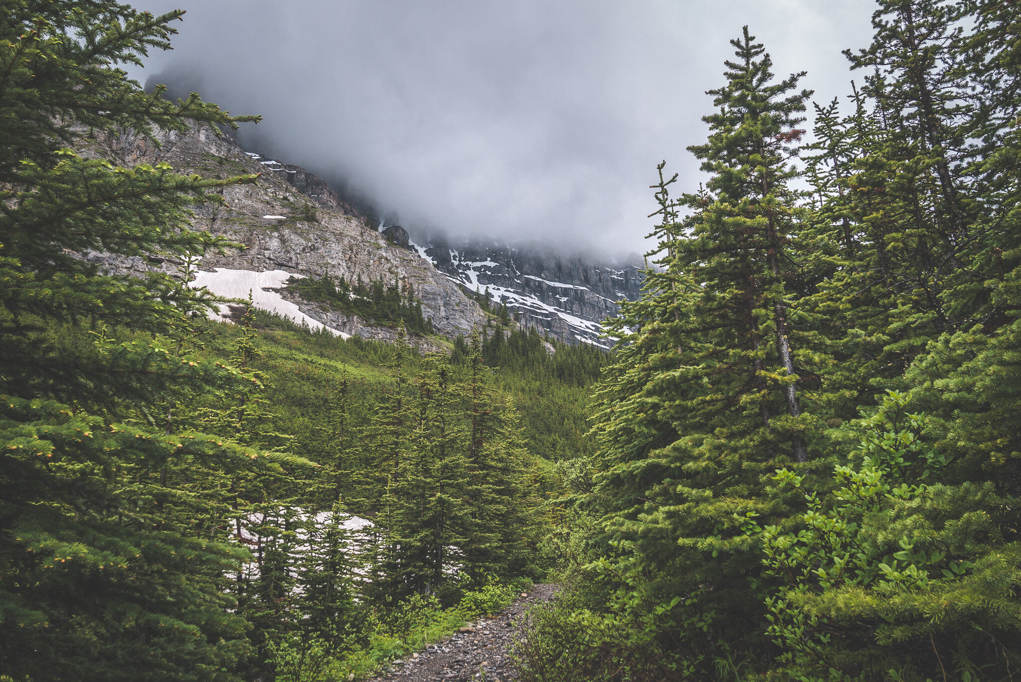
Near the lake, the top of Mount Bourgeau was hiding behind thick fog.

The rain stopped as I reached Bourgeau Lake but the damage was done, I was soaked through. My hands were numb. My thermometer was reading 2°C. It was hard to enjoy the views, not only because of the fog, but also because I had to keep moving to stop my body from shivering.


I filled my water bottle in the lake, removed my wet rain jacket and then climbed up a small scree slope with the only purpose of warming myself up. I pulled a weather report from my satellite device to confirm that the rain would stop for the next few hours. It would be a dry descent.
The lake outflow that forms the creek I had to cross earlier.


But after such a downpour, nothing's ever really dry. The air was still saturated with moisture, the trail was flooded and filled with mud, sometimes ankle-deep. I had to walk at a fast pace to stay warm.
I felt better once below the tree line where I was sheltered from the cold wind. I was finally able to stop admire the views.


I was nervous about the snow bridge and afraid it might've collapsed with the rain. I reached it and of course the creek was now raging. I was able to cross it using the snow bridge again without any difficulty. I guess the temperature was cold enough and the precipitations not substantial enough to damage the icy bridge.
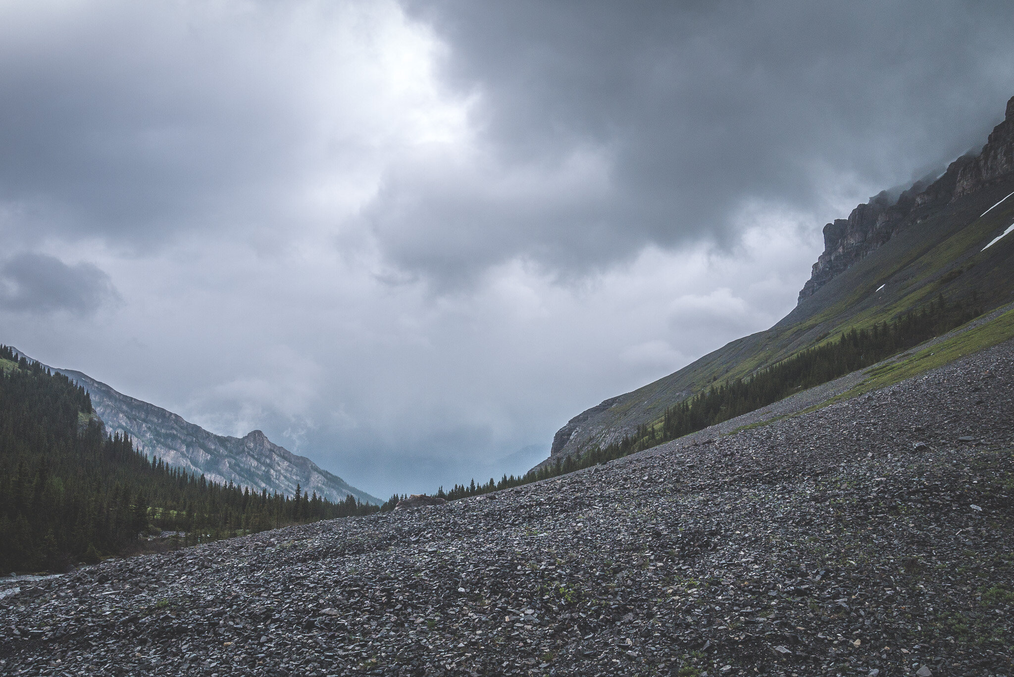
The trail and the general conditions improved after the second creek crossing...

...that included a real bridge this time!

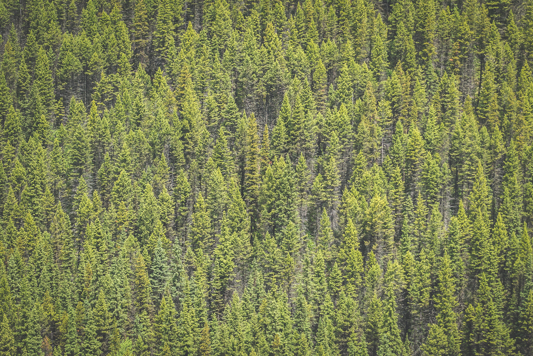
The amount of spruce trees along the trail was incredible. The spruce tips were in season and I couldn't stop eating some. I ended up filling a small ziplock bag and snacked on them while hiking back down. I often get questioned about my love for spruce tips. Widely used by Indigenous people, they taste lemony and have a few benefits, and apart from their good taste, I like that they keep my cravings at bay and act like a free source of electrolytes for my body as they are rich in potassium and magnesium. One thing to consider when picking them is that each tip represents this year's growth for the tree. Therefore, it is important not to pick too many tips from the same tree. I usually grab 4 or 5 and move on to the next one. They are at their best when they still have their little brown cap on.

While Calypso orchids were everywhere and beautiful to look at.


The forest around Mount Bourgeau is so dense. I felt completely submerged in the wilderness while walking along the trail. The rain from earlier had also accentuate the nice spruce scent in the air.


Some interesting geology on The Finger.


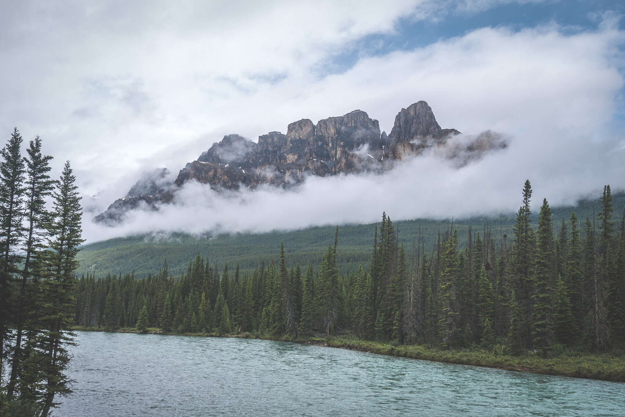
It was still early in the afternoon so instead of heading back to Calgary after my hike to Bourgeau Lake, I opted for a drive on the Trans-Canada Highway to Castle Mountain to observe the low hanging clouds in the mountains. I made a few stops along the Bow River on my way there.


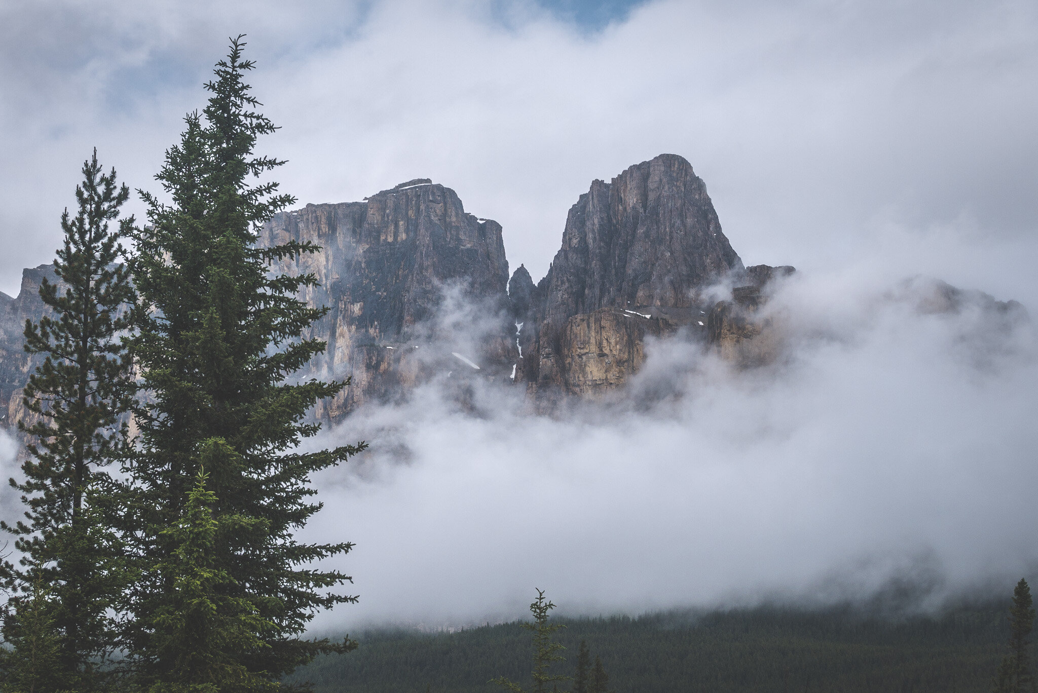
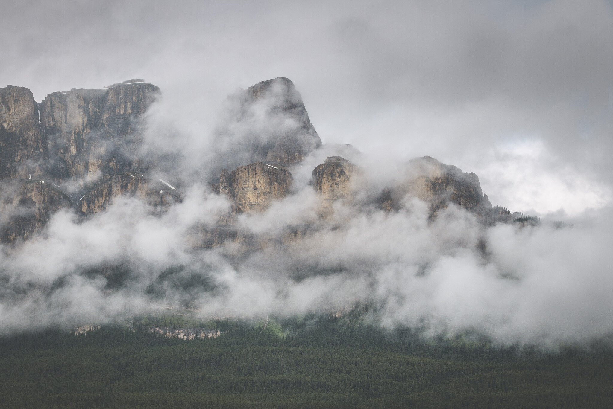
A moody Castle Mountain in the clouds.

And one last stop near Mount Rundle where the fog was literally rolling off of its serrated ridge line. The kind of stuff I like to look at!

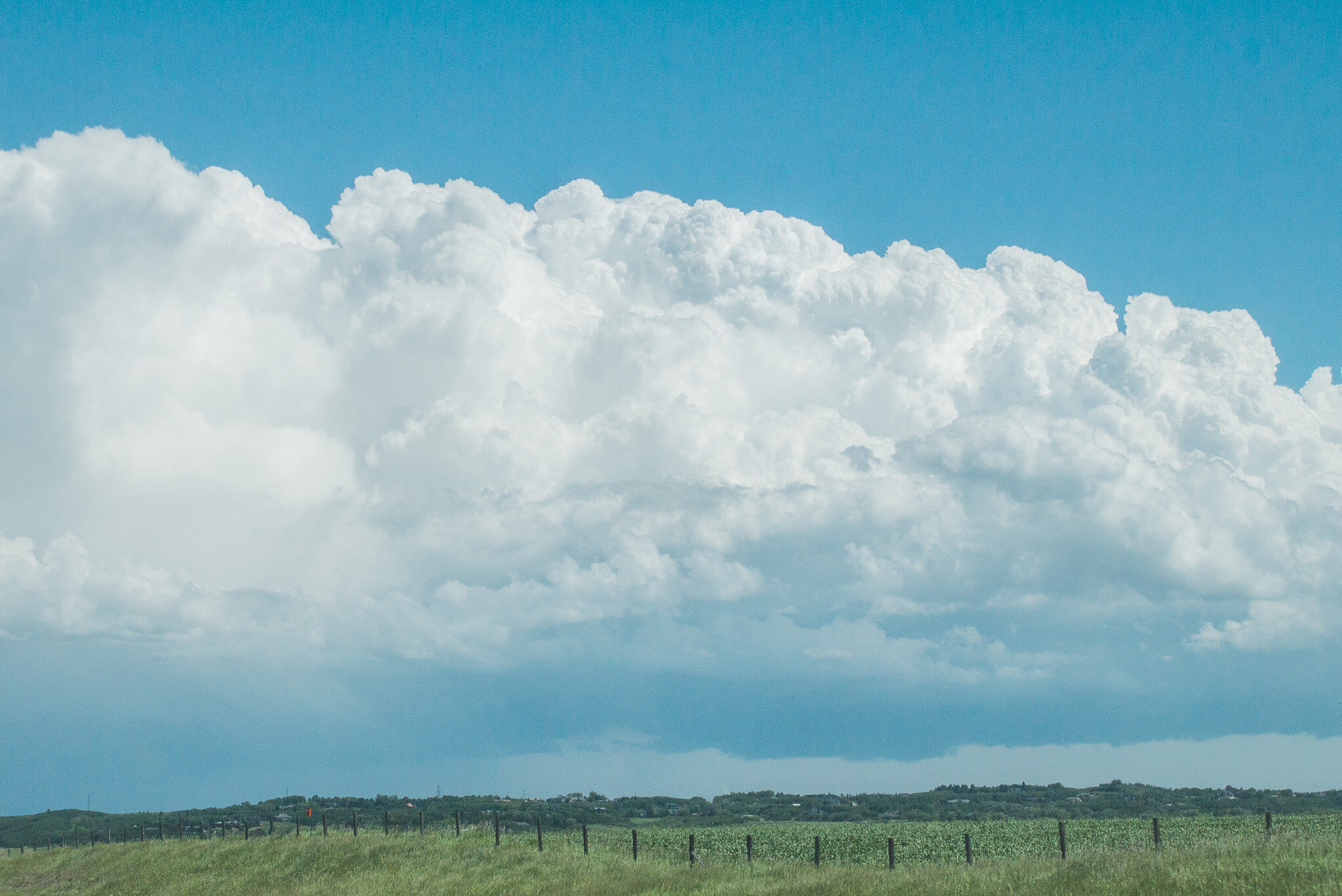
A massive storm was moving in above Calgary and this gigantic Cumulus Congestus cloud was absolutely stunning. I mean the size of this storm cloud was unbelievable. I had a perfect view along the highway approximately 50KM from the city. I could see it stretching from one side of Calgary to the other. I am so in love with this part of the country. The geographic location of this city is in the sweet spot for such big weather patterns to form. The landscape being so vast and open allows me to admire these clouds in all their grandeur. And yes, I got home just when the hail storm hit the city!