Wonder Pass
Only a few days after my last adventure along the Brazeau River, my legs were feeling great and I had the itch to go out again. Solo this time and for an overnight. I literally planned this trip on my way back home from work on the Friday afternoon. Actually, this particular overnight was dictated by the fact that every single backcountry campsite was booked in the Canadian Rockies. Well, almost. There was only one left: Big Springs Campground. Tucked near the south boundary of Banff National Park, it’s located along the trail with the most direct access to the most popular area of the Canadian Rockies: Mount Assiniboine. Often called the “Matterhorn of the Rockies” because of the striking resemblance with the Matterhorn of Switzerland, the entire area around Mount Assiniboine is very difficult to access as all the campgrounds and cabins get fully booked within minutes on the day the reservation process opens for the year. I never cared much for the campgrounds or cabins as being surrounded by hundreds of campers is the complete opposite of what I am looking for in the wilderness. All I wanted was to finally see Assiniboine from up close and other than on a picture. My plan was ambitious: hike to Big Springs on the Friday evening and then hike up to Wonder Pass on the Saturday and come back to the trail head by Saturday afternoon. A total of almost 50KM but 10KM on the first day and close to 40KM on the second.
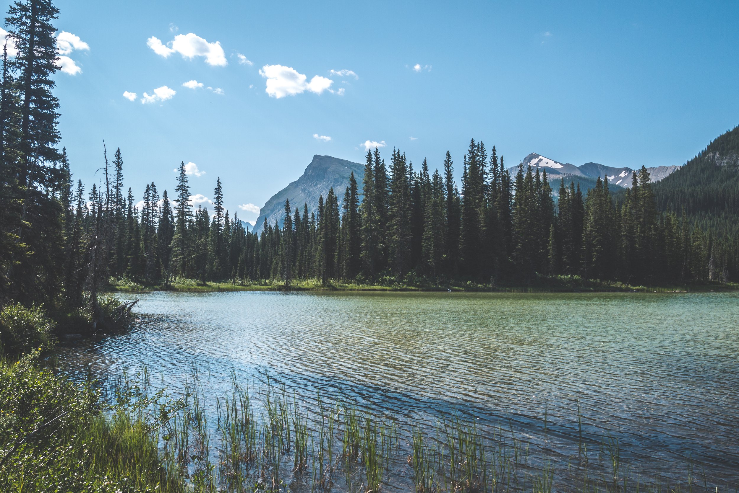
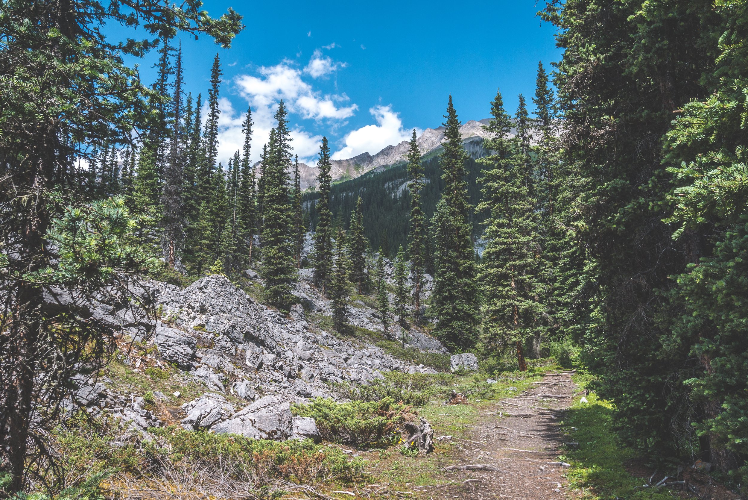
The trailhead is located in Spray Valley Provincial Park, part of Kananaskis Country. After a two-hour drive from Calgary, I was finally ready to start my overnight adventure. I started walking at 5PM and only had around 10KM to reach Big Springs Campground.


The trail was fairly flat and in no time I was already crossing into Banff National Park. It was a very hot day and I was happy to hike under the trees for the most part.


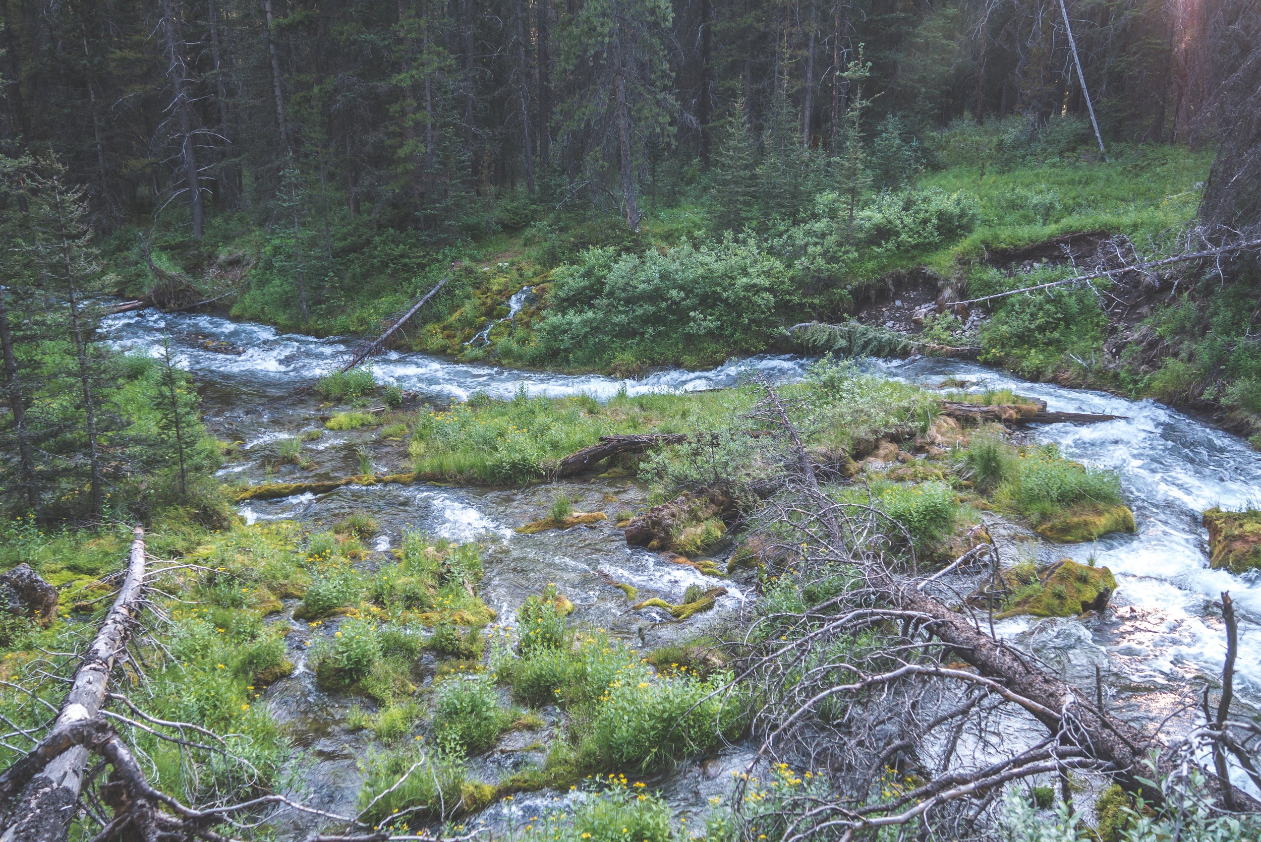
Bryant Creek


As I expected, only half of the campsites were occupied despite the Parks Canada website showing that only one was available when I booked. This is becoming a big issue and it’s very frustrating when people book their campsites in January and never show up when the summer comes. It prevents a lot of hikers from enjoying the backcountry. That’s a conversation for another day… For now, I picked a site and pitched my tent and made my way to the eating area as I was starving.


My cozy little camp spot.
I showed up at the eating area with my food bag and stove in hands only to find one of the two tables occupied by a family playing cards and the other with a camper sitting on it barefoot, reading a book. I said “hi” to both parties and turned around to find a place to eat along the river. As much as I am a social guy, I just wanted solitude and eating on a table next to a barefoot person was not appetizing.

Dinner was consumed in a few minutes. An what better way to digest than walking a little? Having done absolutely no research on this area before leaving, I enjoyed walking around and checking out the Big Spring that the campground was named after. This has to be the biggest in-ground spring I have ever seen. The amount of water coming out of the ground was astonishing. And so were the bugs, so I didn’t linger for too long.


With the other two parties in their tent, I was able to explore the campground. I probably won’t ever come back here again, but I can see why it was established here, providing a nice option for hikers accessing Mount Assiniboine. I rarely stay in established campgrounds, but if I do, might as well expect a real picnic table and at least a decent access to water! Big Springs offers no real privacy between the sites and it’s almost directly on the trail. Perhaps the bugs and scorching heat was making me a little grumpy, or will I just always be very critical of Parks Canada!

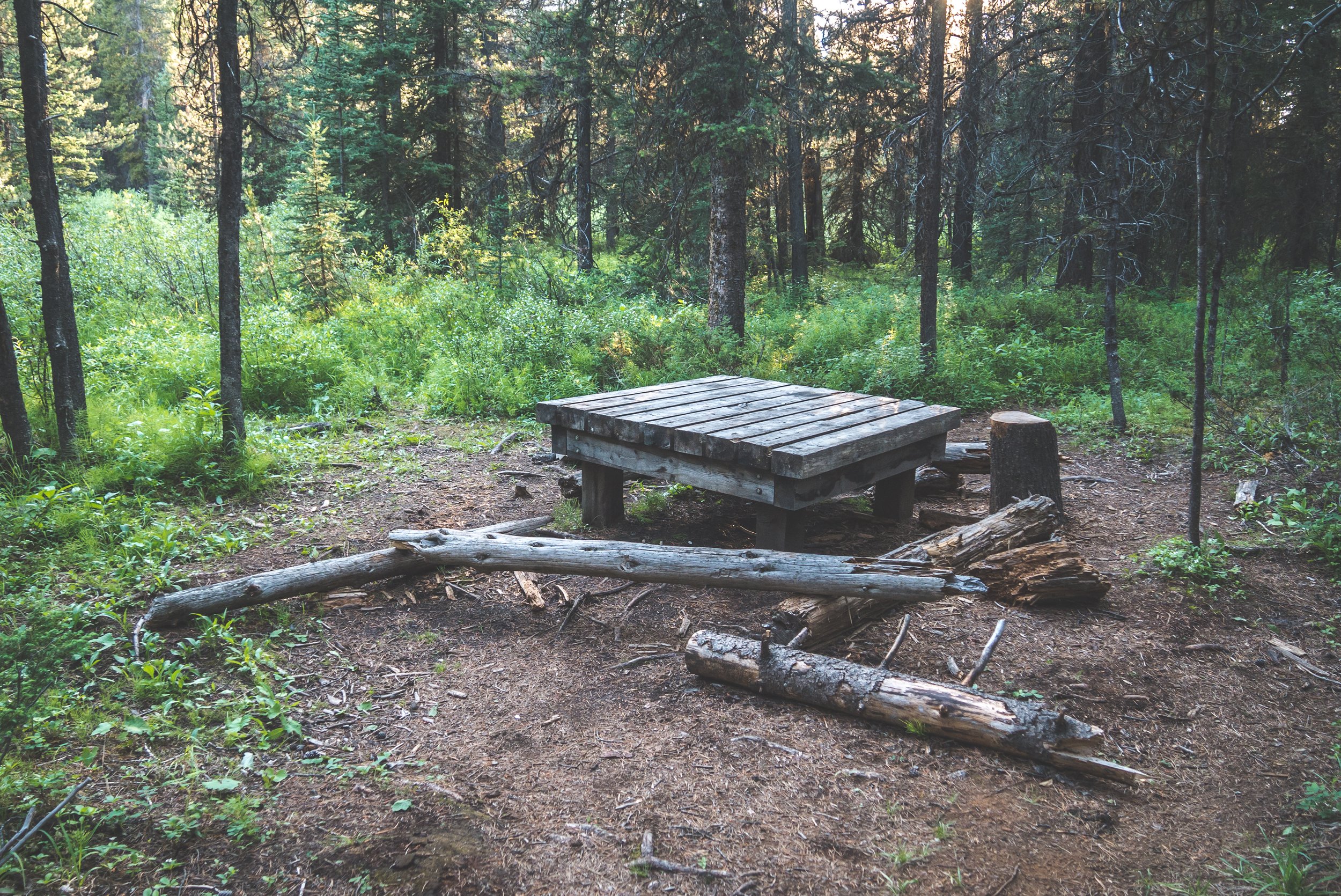
Is this a table or a bench? Or both? Not sure! I wonder how much more complicated it would have been to build benches?
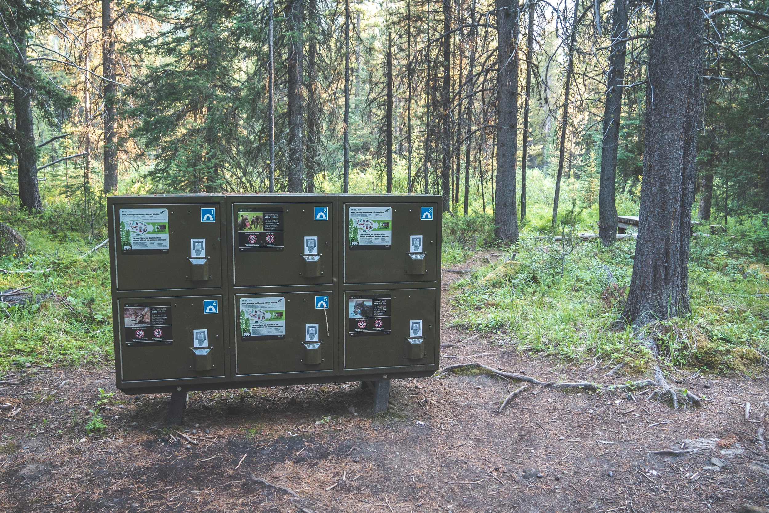
Food lockers. An eye-sore in any backcountry campground, but a necessity.
I spent the last hour of daylight reading at camp and mentally preparing myself for the next day, a 40KM hike up Wonder Pass and back to the Mount Shark trailhead.

The sun was up early but what woke me up were the other campers making so much noise at 6AM. Was I ready to leave this camp and start hiking? You bet I was. I packed my bag, skipped breakfast and started hiking. Peaceful I was again, alone, with no other sounds than the birds chirping.

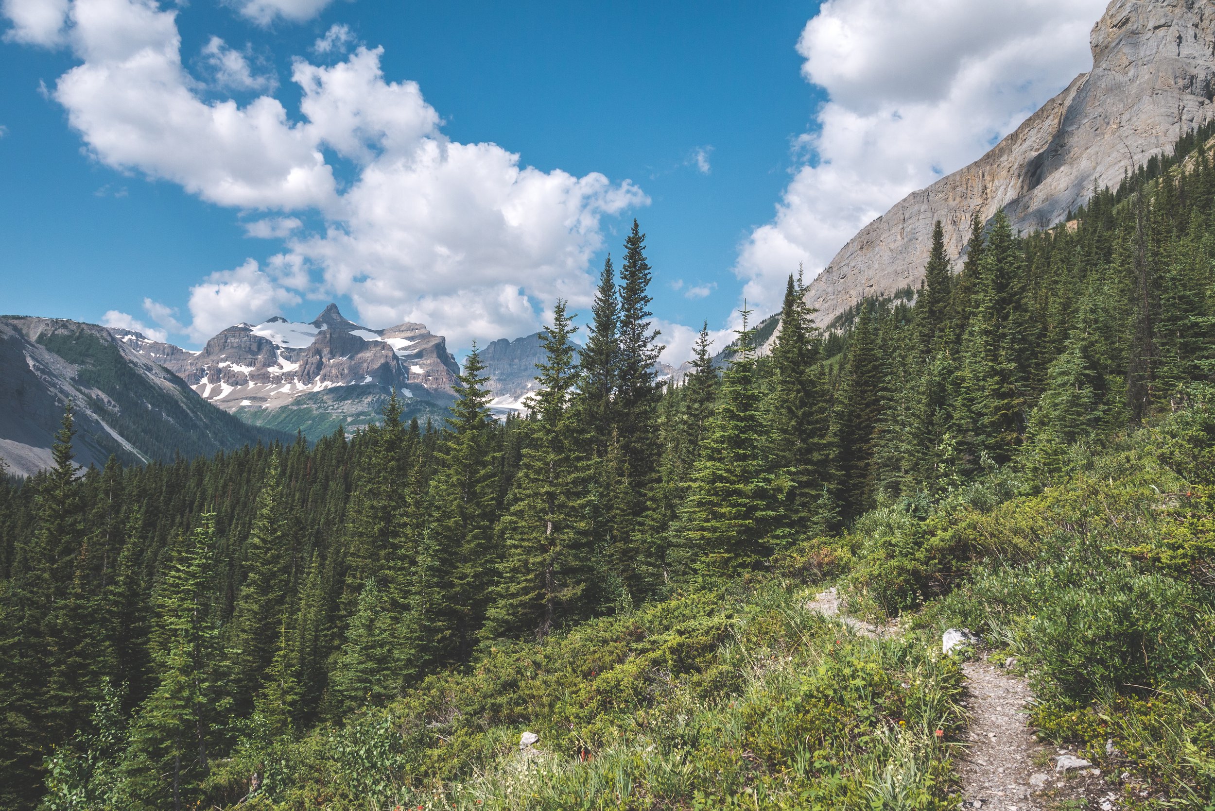
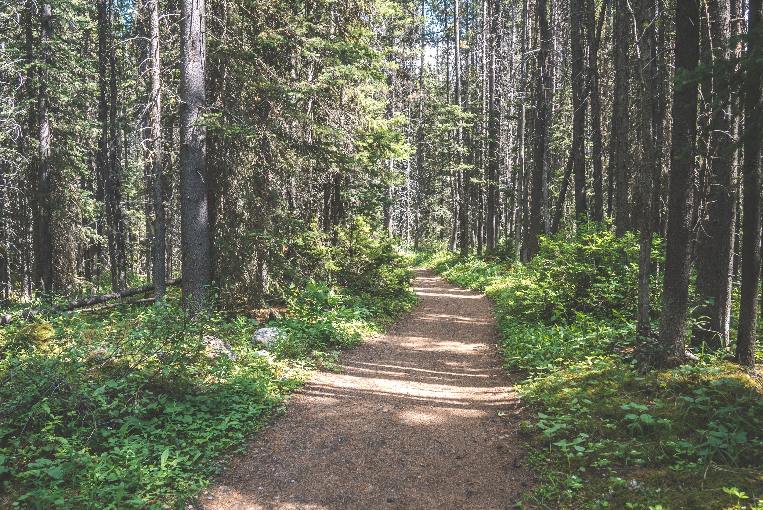
The trail was mainly flat and a few kilometers were covered in no time. I came to a very busy intersection where I decided to keep pushing to Marvel Lake before stopping to have breakfast.

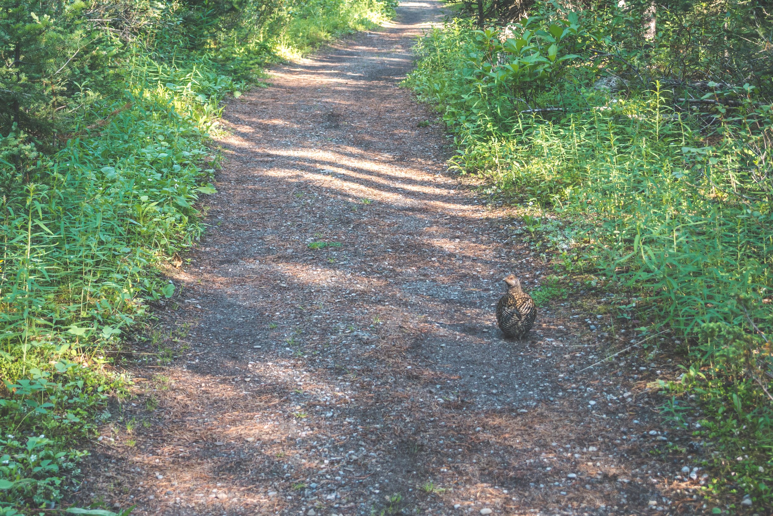
Mountain Grouse
Unnamed lake

Same unnamed lake
I reached Marvel Lake, or at least the east end of it. It is indeed, marvelous! It’s a big one, 4KM long. After stopping here for breakfast, I would be following it all the way to the end before ascending to Wonder Pass.

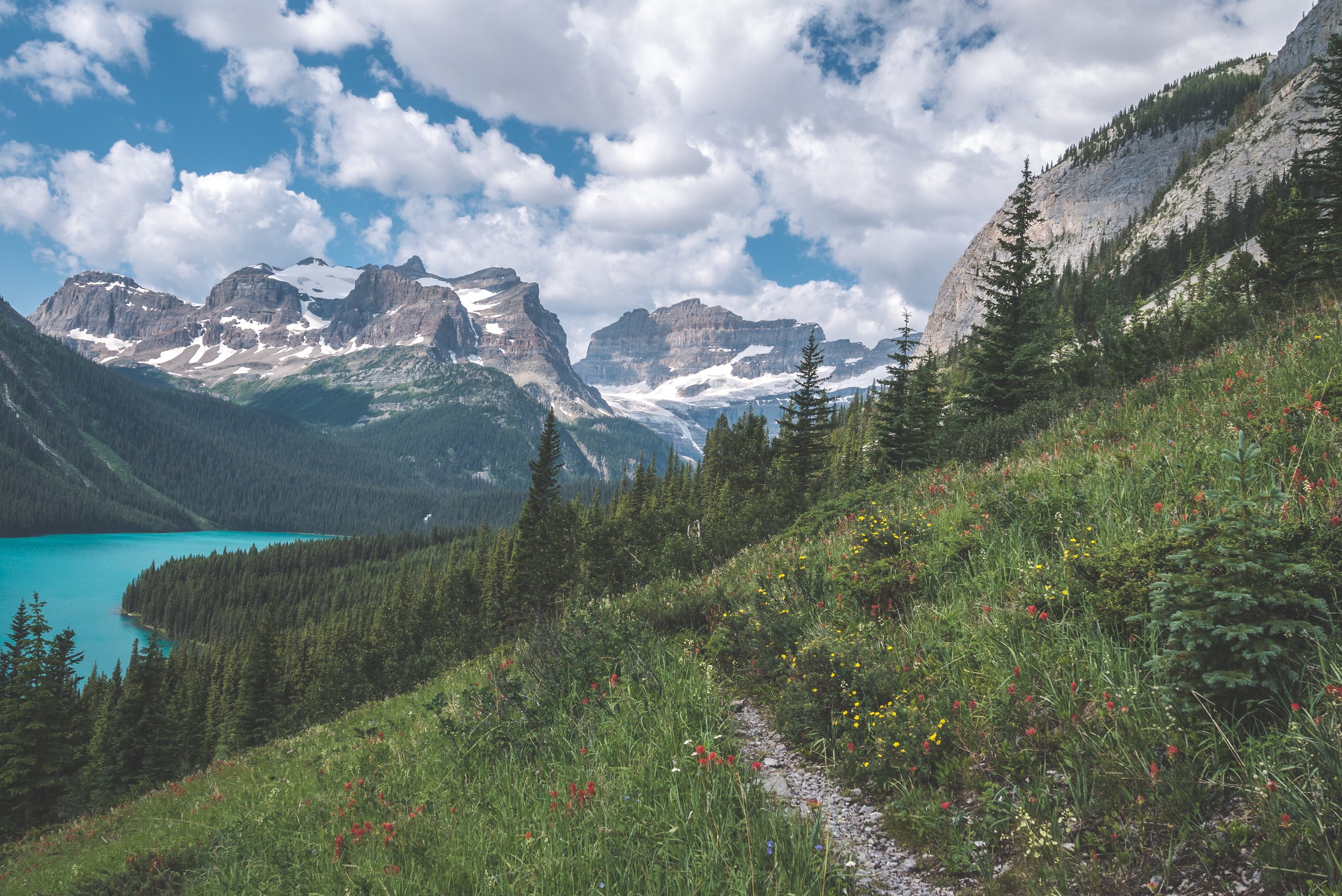
The trail doesn’t waste any time climbing up close to 1700ft above the lake. This is very steep terrain and such a narrow single track trail that a good balance between looking at the lake and at your feet is required… something I am usually pretty bad at, always prioritizing the views!

Looking behind me. I came from the Bryant Creek valley that comes around the tip of the mountain.

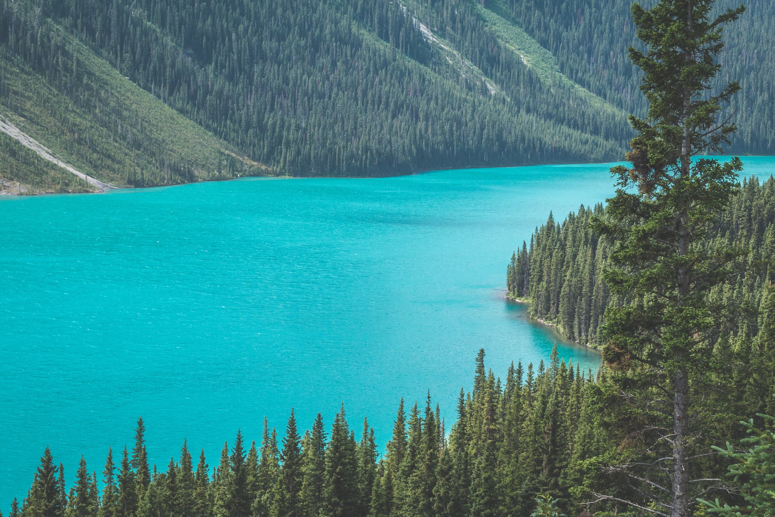
No wonder why someone came up with the name Wonder Lake. The color of the water is simply stunning. Just like pretty much all glacier-fed lake, the silt is responsible for this turquoise hue. The sun reflecting on the minerals will occasionally change the color of the water.

Wildflowers were in full bloom!
I mean… come on!!!

The icefield above Wonder Lake.
The trail followed the lake for a few kilometers. Near the end of it, a right turn took me right up the meadow below Wonder Pass via a bunch of switchbacks. The trail was very steep and the hot weather was starting to wear me down. It had been a while since my last water source and it’s with a dry mouth and sweaty face that I reached the top of the switchbacks.

The first few steps in the meadow, looking behind me.

The climb wasn’t over, but way more gentle. A little stream coming from the melting snow provided some much needed hydration. Less than 20 minutes left to reach the pass and the sun was hotter than ever, my mini thermometer showing 32C. It’s the hottest temperature I’ve ever hiked it. I’m not a fan of hot days on trail!

Here I was, on the Continental Divide, the border between Alberta and British Columbia. Happy to be done with the climbing but also going insane because of the mosquitos. There was absolutely no wind and being covered in sweat meant I was a real mosquito magnet. Once I was able to ignore them for a few seconds, I realized that Mount Assiniboine wasn’t even visible from the top of the pass. AHAHAHAH! I laughed. Because it was funny or because it was pathetic? Both! I am so good at trip planning that this detail was overlooked when I put this adventure together at the last minute. But with such majestic views, there was no “all this for nothing” thoughts going through my mind. I could’ve easily gone down Marvel Pass on the BC side for 3KM and get my view of Assiniboine. But with more than 22KM to go to the trailhead, there was no time to waste.


Wonder Pass - Looking into BC, Mount Assiniboine is hidden around the mountain on the left.


Wonder Peak

The Towers
I felt great mentally as I left Wonder Pass behind. Mount Assiniboine was for another day and my focus was now on the long hike ahead of me. If I could manage to stay hydrated, I knew I could maintain a 5KM/hour pace and make it back to my truck just past 6PM.


How badly I wanted to stand under that small waterfall!

Just before heading back down via the switchbacks.

One last glimpse at the icefield while drinking a full liter of water in a few seconds and I was back at it, maintaining a fast pace. Having dealt with the incredible views on my way in, I could dedicate my full attention to my footing.


I’ll never get enough of this color!

I made it to the end of the lake and I was back on flat ground. I drank 7 liters of water over the last 10KM and my body was still showing signs of dehydration. I stopped at the Marvel Lake Campground and had a fun encounter with two Parks Canada wardens. It was also a forced opportunity to take a break. Too stubborn to stop because of my fast pace, resting for twenty minutes or so was a necessity. Working outside a lot for the last 15 years has taught me a thing or two about heat exhaustion and let’s just say that I recognized some of the signs just before stopping. At least from here, most of the trail would be in the shade.


6.7KM to go… let’s go!
I couldn’t feel my legs anymore. My feet were hurting and I had a major case of butt chafing because of the sweat. The last 3KM on this open trail was never-ending. Eventually, the mountain in the back grew taller and bigger, the only visible sign I was still moving forward.


Less than a kilometer shy of hitting 40KM, I got into my truck and turned the air conditioning all the way up. What a day. My longest one so far in the mountains. And the hardest physically with the extreme heat. I wanted to see Mount Assiniboine, but first and foremost, I wanted to challenge myself. And on this I can say mission accomplished. I needed this suffering. On most of my solo trips, I make big plans of long days with ambitious itineraries. I realized lately that I sometimes doubt my capacity to push myself and walk these kilometers. Being out there solo means it’s me against myself. Sometimes the body can’t follow the mind and sometimes it’s the opposite. But on this day, both my body and my mind were walking hand in hand.
It was tempting to walk around the parking lot to hit 40KM. But I had to keep it real!
I stank horribly and was disgustingly sticky, covered with dried sweat. But I left the parking lot with a big smile on my face. I was ready to go home and couldn’t wait to stop by Tim Horton’s at the Bearspaw Kananaskis Travel Centre to get a large Iced Capp. Country music was blasting in my truck. The only time I stopped singing out loud was when I drove past this sheep. I didn’t want to torture him with my bad singing LOL!


Licking salt and shedding its winter coat!
Where will the next adventure take me? Stay tuned to find out!